Interactive Mapping Done Right.
Engineered for WordPress – Designed for Nonprofits, Chambers, and Mission-Driven
Organizations.
Not just pins on a map!
IronMaps™ is an award-winning WordPress mapping plugin built for non-profits, chambers, tourism destinations, and multi-location businesses that need more than a basic directory or locator.
Whether you're promoting businesses, connecting people to services, or helping customers find retail locations, IronMaps™ gives you the tools you need. With no-code customization, mobile-first design, and advanced filtering, it delivers interactive maps that drive engagement and keeps traffic on your site, where it belongs. From nonprofit resource directories and Chamber member maps to tourism guides and retail locators, IronMaps™ now handles 1,000 locations without performance issues.
$199/year
Own your data. Replace outdated PDFs and static directories. 14-day free trial to start mapping smarter.
IronMaps™ is available only to US customers.
A mapping solution built for you
By a team who understands your needs
Non-Profits & Community Organizations
Connect people with essential services through interactive maps built for mission-driven organizations.
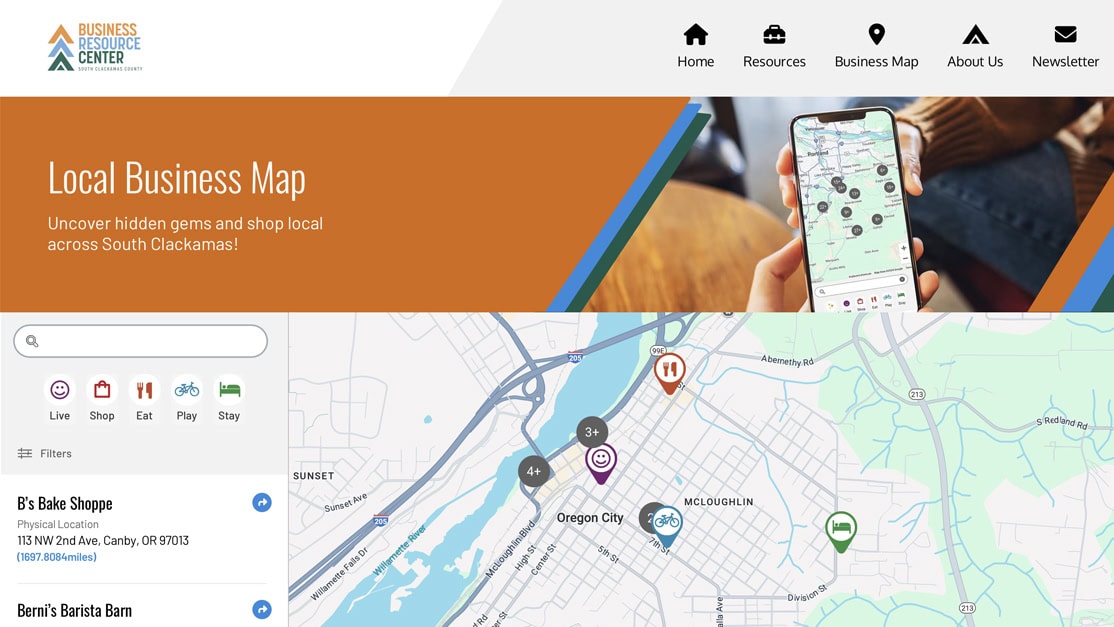
IronMaps™ supports mission-driven organizations with privacy-safe, category-rich maps that work great on mobile devices. Replace outdated PDFs and complex systems with an intuitive tool that helps people in crisis find resources quickly. Plus, it supports grant reporting with visual impact data, with no technical skills required. Perfect as a nonprofit directory map, community resource locator, or social services directory.
Chambers & Business Associations
Transform static directories into dynamic, interactive maps that showcase your members.
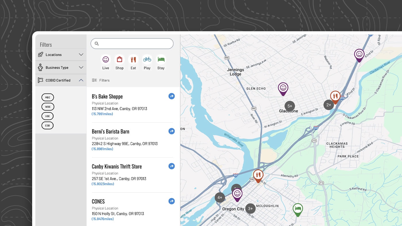
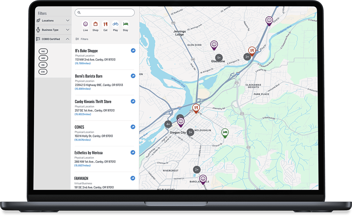
IronMaps™ is purpose-built for chambers of commerce, with features tailored to your needs. Highlight certifications like COBID and veteran-owned, run seasonal campaigns with shareable map views, and replace clunky tools like ChamberMaster or GrowthZone with a member directory map you control. With IronMaps™, you own your directory with rich schema markup that helps search engines understand your member data, making it easier for people to find your members online and in local search results.
Tourism & Destinations
Turn visitors into explorers with interactive maps that bring your region, services, and destinations to life.
IronMaps™ lets you showcase attractions, events, and local businesses in a beautifully branded experience that works on any device. Group listings by category or region, and highlight seasonal points of interest. Whether you’re promoting a small town or a statewide trail, IronMaps™ helps travelers navigate with confidence, while you stay in control of the experience.
Retailers & Multi-Location Businesses
Turn location discovery into conversions with branded, responsive maps.
IronMaps™ helps your customers quickly find stores, distributors, or product availability. Built for both DTC and wholesale models, it includes distance-based search, regional filtering, and seamless brand integration. Keep traffic on your site instead of sending it elsewhere, and manage locations easily with bulk import and export tools.
IronMaps™ in Action
See what makes IronMaps™ so special
Video Introduction
A comprehensive walkthrough showcasing IronMaps™ in action. We demonstrate its core features, user interface, and filtering capabilities that help with its ease of use.
Customer Spotlight
IronMaps™ helped connect 5,000+ businesses and facilitated more than $200k in economic impact through the Business Resource Center and retail locator implementations.
Key Features
Everything you need for smarter, more engaging maps
No-code tools with an intuitive backend that anyone on your team can manage. Perfect for nonprofits and chambers without technical staff.
Fully responsive, mobile-first design that looks great and functions seamlessly on any device. Essential for crisis resource discovery.
All map data is securely stored on your own WordPress site, ensuring full privacy, control, and compliance with nonprofit data protection standards.
Create custom filters for certifications like COBID and veteran-owned, plus regions and categories to support personalized discovery.
Easily manage large sets of locations with simple CSV import/export tools for fast updates. Ideal for seasonal campaigns and member directory changes.
Award-winning solution built in Oregon by a small team that understands US business needs. Responsive support when you need it.
Learn more in our FAQ and Documentation